Operations
Condition surveys
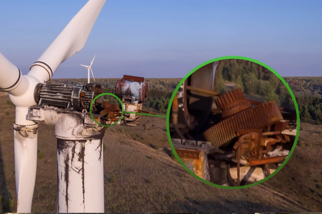
Inspect structures and equipment without stopping operations: identify defects, deformation, corrosion, and damage — with detailed photo/video evidence.

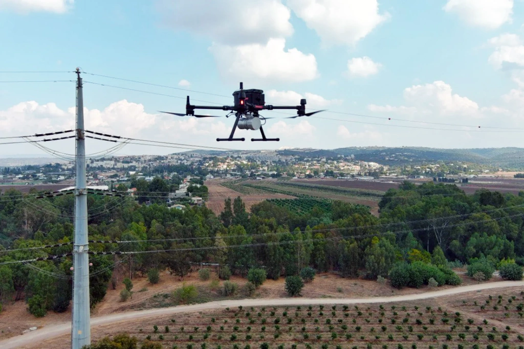
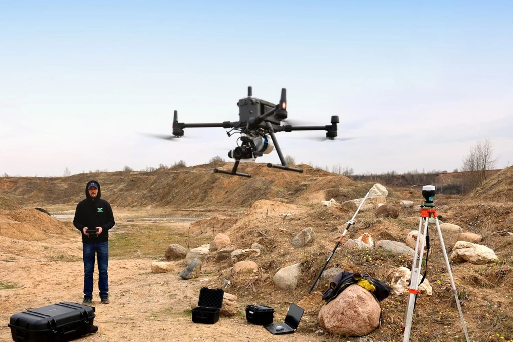
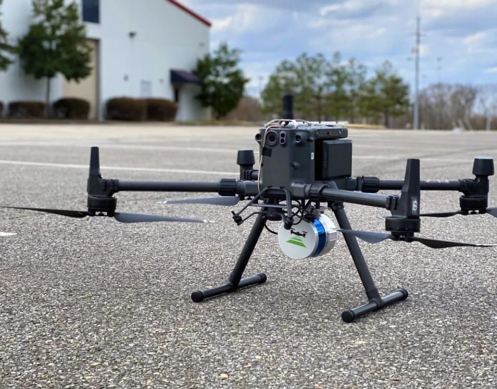
We provide aerial inspection and monitoring services worldwide using UAVs: high-resolution zoom photo/video, thermal diagnostics, photogrammetry, and LiDAR. Delivering clear visual evidence and accurate measurements fast — with minimal downtime and zero risk to personnel — supporting operations, maintenance, construction, and contractor contr
UAVs make it safe to inspect hard-to-reach and hazardous areas, capture changes quickly, and produce orthomosaics, 3D models, and measurements — with minimal downtime and reduced human error.
UAV monitoring means fast capture of accurate data and clear documentation of an asset’s condition.
Operations
Inspect structures and equipment without stopping operations: identify defects, deformation, corrosion, and damage — with detailed photo/video evidence.
Construction
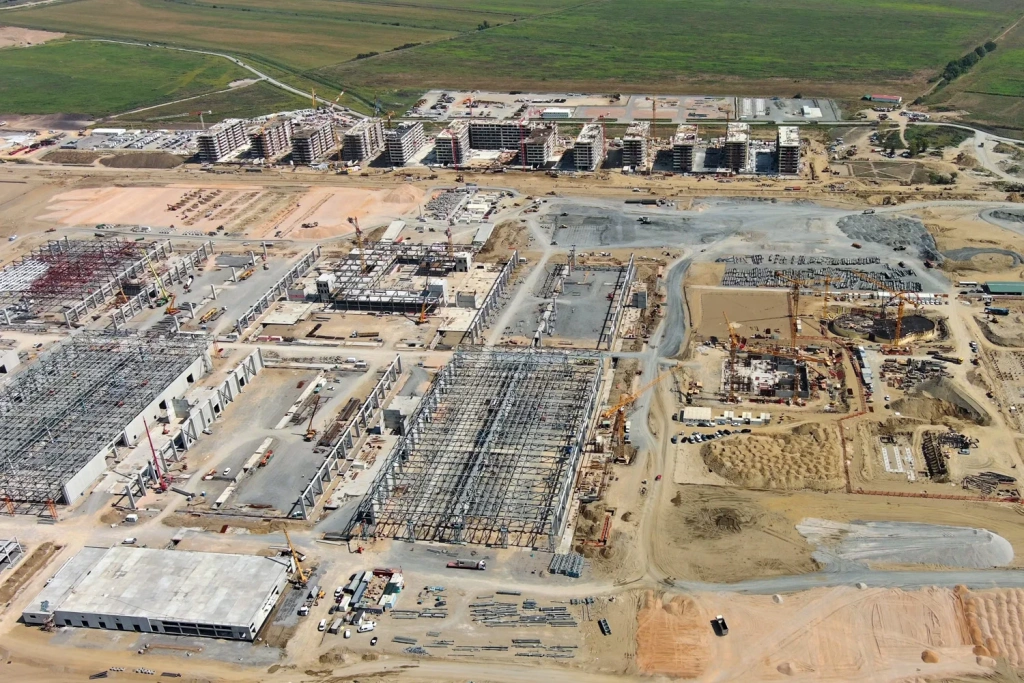
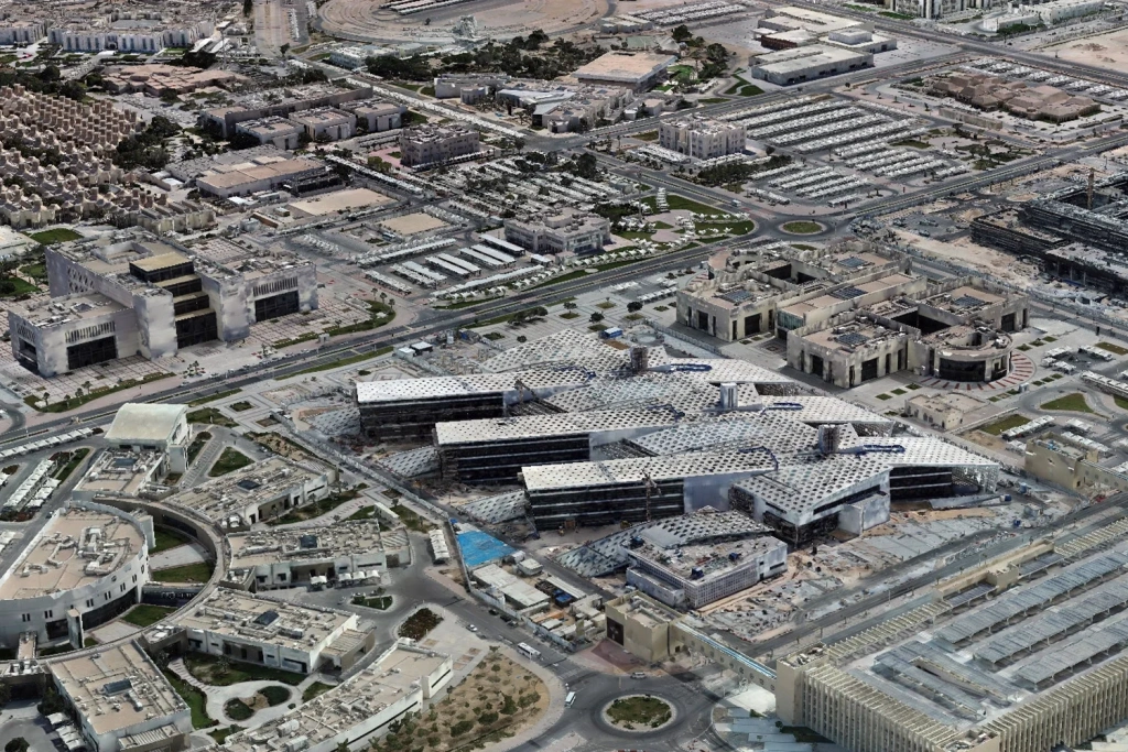
Planned site monitoring: “before/after”, stage control, as-built documentation, volume checks, and verification of actual site conditions.
Engineering
Orthomosaics, digital maps, 3D models, point clouds (LiDAR), and digital terrain/surface models — for design, maintenance, and reporting.
Why UAVs
We select the right capture method for your asset and objective — from buildings to linear infrastructure.
Industry and Oil & Gas
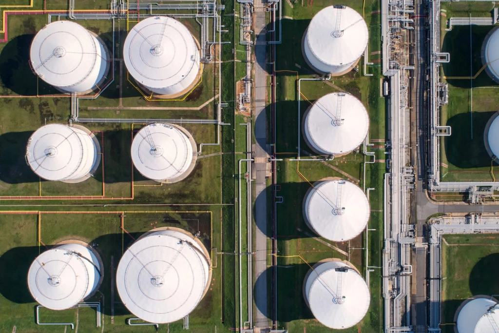
Workshops, tanks, pipe racks, units, pipelines, roofs — photo/video + zoom, photogrammetry, LiDAR.
Energy
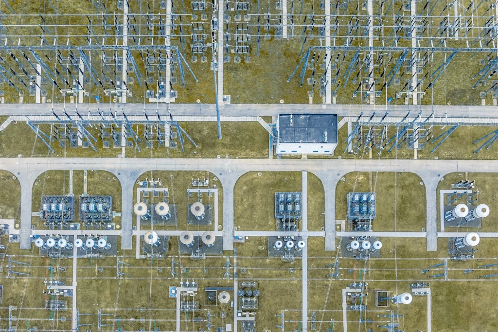
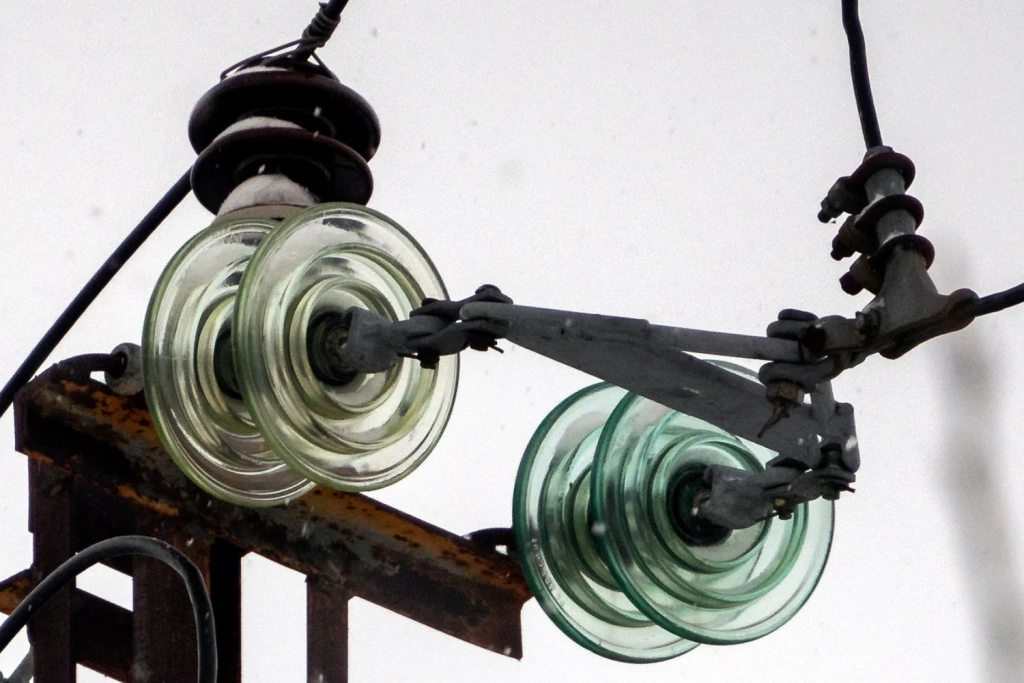
Drone inspection: photo/video + zoom, photogrammetry and LiDAR for condition and geometry checks.
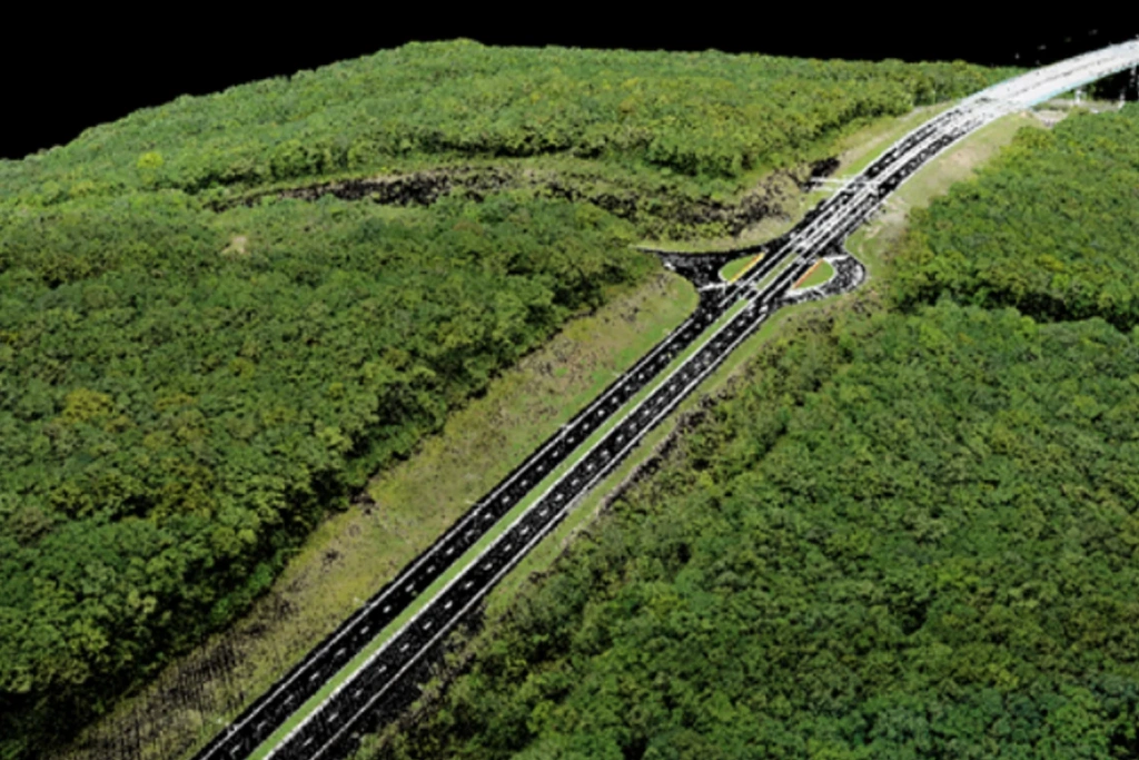
Other linear assets
Corridor mapping and documentation: orthomosaics, 3D, change tracking, and a base layer for design.
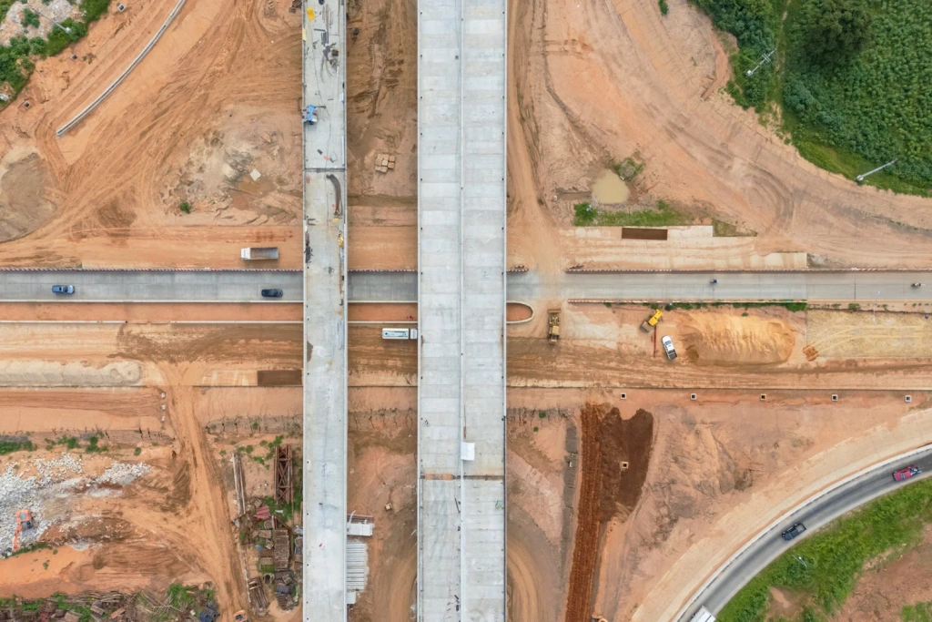
Construction
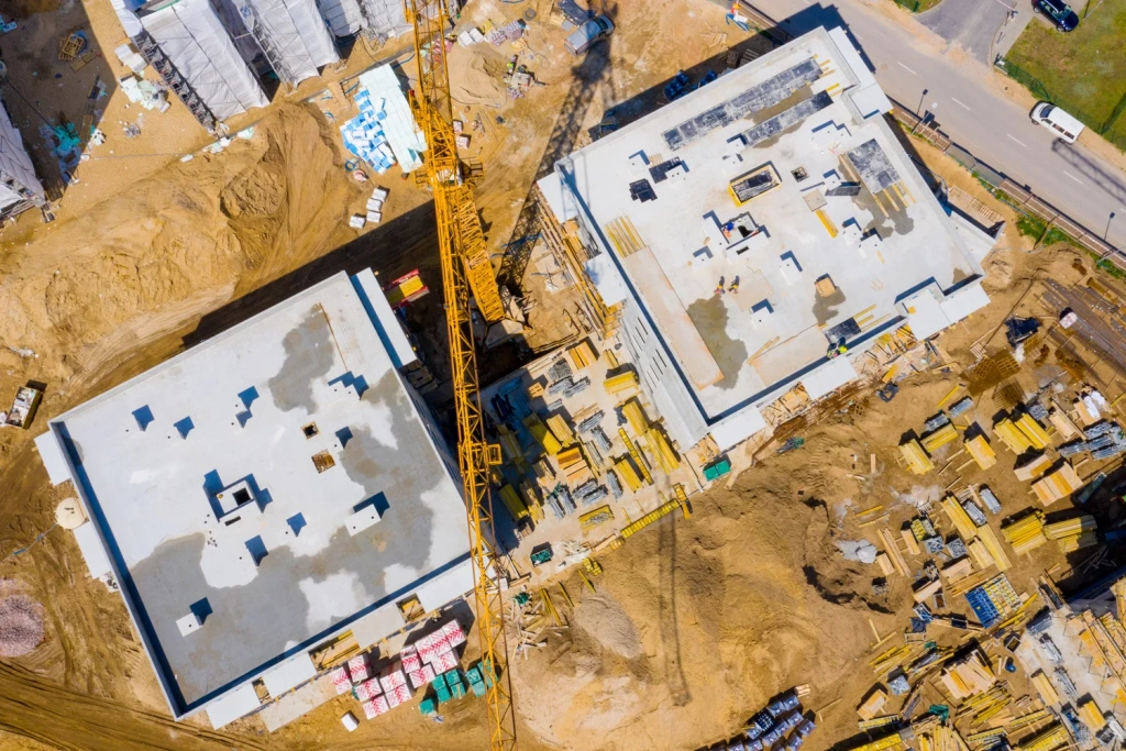
Progress tracking, volume control, stage photo records, and “before/after” comparisons.
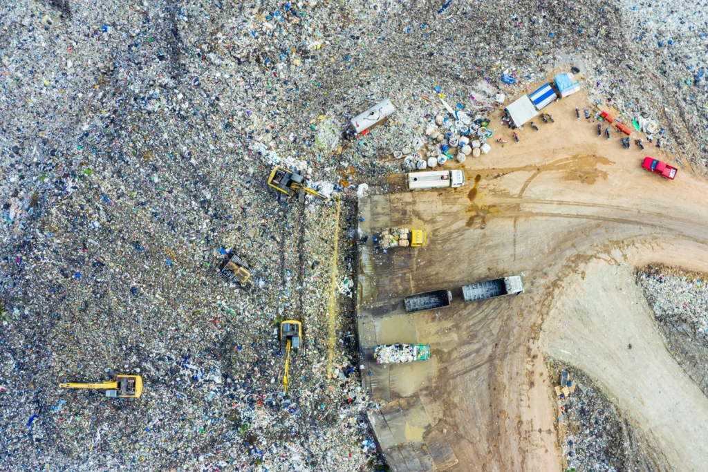
Mining
Volume and change monitoring, slope/terrain assessment — LiDAR and/or photogrammetry.
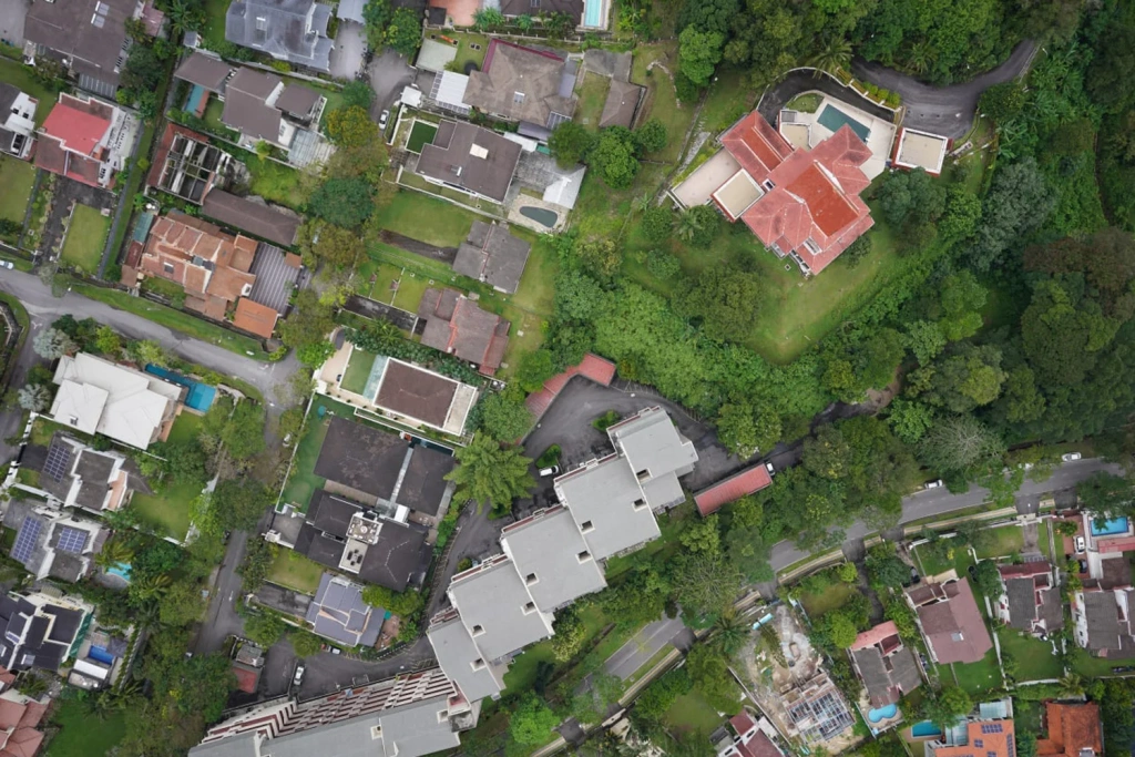
Environment and land
Boundary and change control, documenting problem areas through photo/video and mapping outputs.
We choose the right technology for your goal: defects, thermal issues, geometry, mapping, 3D, and change control.
Visual inspection
We capture the required elements from multiple angles and document defects and deformation. Zoom helps to spot small damage.
3D and mapping
We produce orthomosaics and 2D/3D deliverables, and carry out measurements: areas, volumes, heights, and change dynamics.
Maximum geometric detail
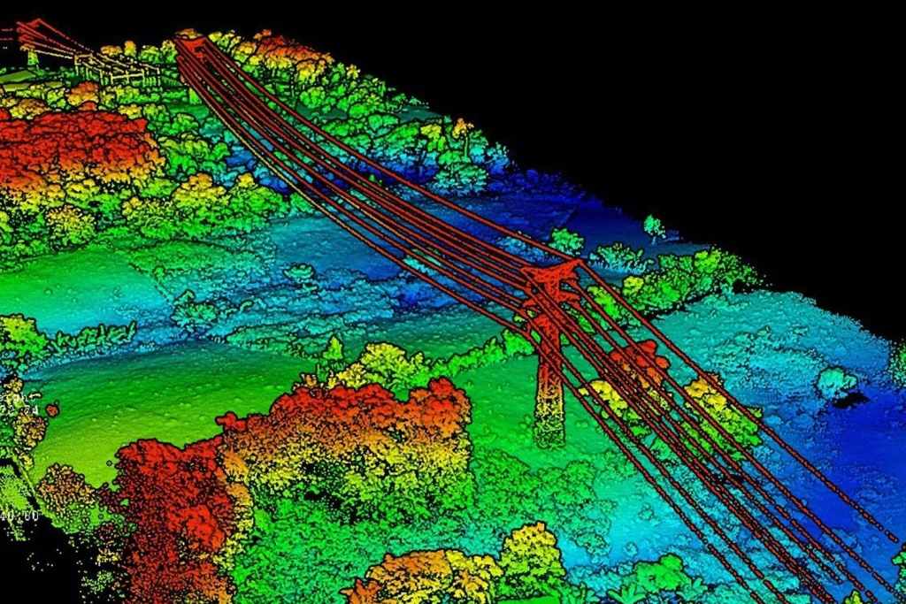
We generate an accurate 3D digital twin of the asset and terrain as a point cloud. Ideal for complex geometry and long linear assets.
We select the equipment and methodology to match the area, conditions, and deliverable requirements.
The deliverable set depends on the ToR — we provide outputs that are easy for engineers and management to use.
UAV/p>
Primary area capture: photogrammetry delivers detailed orthomosaics, while LiDAR provides dense surface/terrain geometry. We choose a single method or a combined workflow to suit the task and site conditions.
MLS
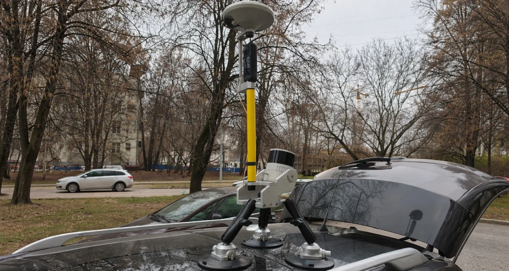
Ground-level detail for local areas: infrastructure, access roads, pads, tie-ins and zones where you need higher point density at object level.
From scoping to delivery of the report and files. Transparent, contract-based delivery.
We confirm the asset, objectives, monitoring frequency, and deliverable formats.
We agree capture areas, site requirements, and the payload configuration.
We fly the missions, capture the required areas, and verify data quality on site.
We generate orthomosaics/3D/point clouds and carry out annotation and analysis per the ToR.
We deliver the report and files in agreed formats. Closing documents are provided under the contract.
The deliverable set depends on the ToR — we provide outputs that are easy for engineers and management to use.
Media
High-resolution imagery, close-ups (zoom), and marked-up problem areas by section/point.
Geodata
Orthomosaics (GeoTIFF), maps, 2D/3D models, DTM/DSM, point clouds (LAS/LAZ) — in the agreed format.
Documents
We agree the structure and format to suit your task (PDF/Word + appendices).
| ID | Section | Description | Priority | Evidence |
|---|---|---|---|---|
| P-03 | KM 2+740 | Deformation at the fastening assembly / inspection and repair required | Critical | Photo + zoom |
| P-07 | KM 6+120 | Clearance infringement / refine using point cloud and re-check | Critical | LiDAR |
| P-10 | KM 9+300 | Local defects in structural elements / planned repair | Medium | Photo + zoom |
These depend on the inspection type, asset scale, and processing requirements.
Timeframes
Typical: mobilisation and on-site capture — from 1–2 days (or per the monitoring schedule); processing and reporting — from 1–2 days, longer for large assets and complex analytics.
Cost
Pricing depends on the capture method (visual/photogrammetry/LiDAR), area/length, accuracy and deliverable requirements, asset complexity, and logistics.
For a quotation, we typically need: asset type, region, inspection objective, desired outputs (report/orthomosaic/3D/point cloud), approximate area/length, and timeline.
Not sure about something?
If you have any questions and would like a consultation, email us at info@topodrone.com — we’ll talk you through everything in detail, including the ToR, deliverable formats, and timelines.