Construction
Construction and industrial sites
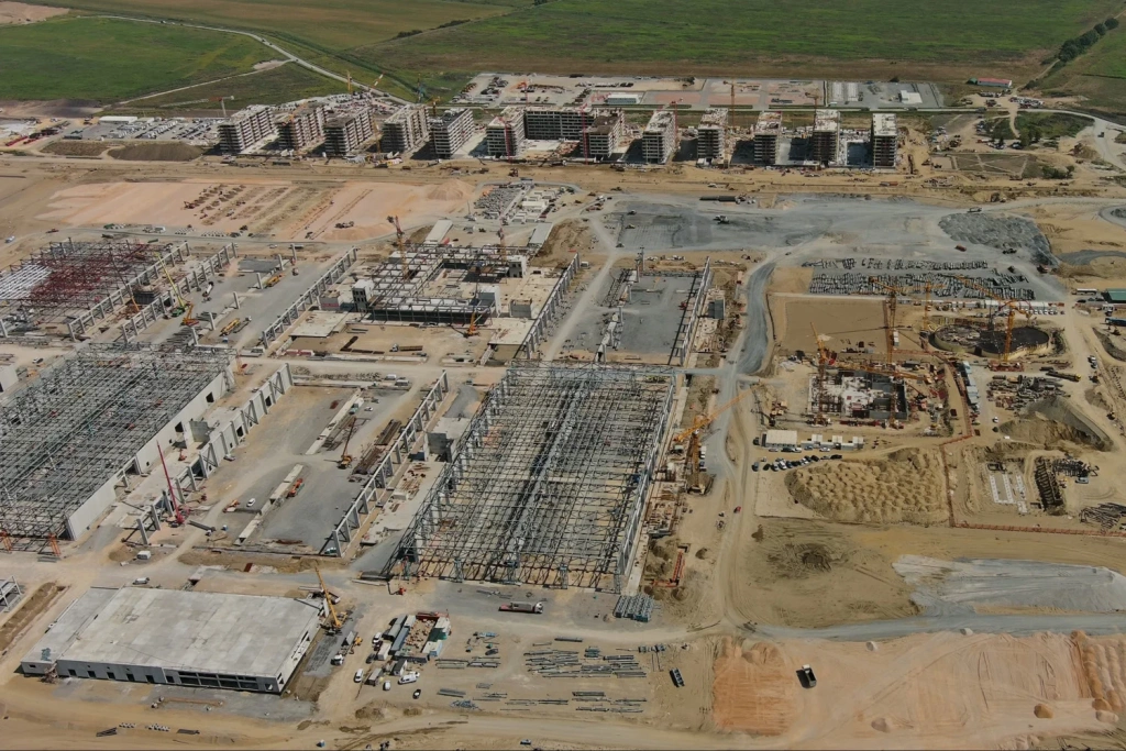
A topographic base for masterplanning, grading and landscaping, and for preparing survey data for design.

TOPODRONE delivers topographic surveys at scales 1:500, 1:1000, 1:2000 and 1:5000. Before we start, we agree the scale, layer content, accuracy requirements, horizontal and vertical datums, the list of deliverables and the programme—so the outputs fit straight into your CAD, GIS or BIM workflow.
Survey methodology, quality control and deliverables are defined upfront in the scope of work to match your project requirements.
Sites, areas and linear assets—when you need measurable outputs and a clear, usable deliverables set.
Construction
A topographic base for masterplanning, grading and landscaping, and for preparing survey data for design.
Linear assets

Extended sections (roads, access tracks, corridors)—deliverables tailored to your needs: plan, spot levels, layers and, where required, profiles/sections. Mobile laser scanning can be used where appropriate.
Challenging environments

Where GNSS is unavailable or restricted, we use SLAM. This approach works well in complex terrain and constrained environments.
Typical scenarios where a reliable topographic base, accurate terrain model and a structured layer set are required.
Use cases
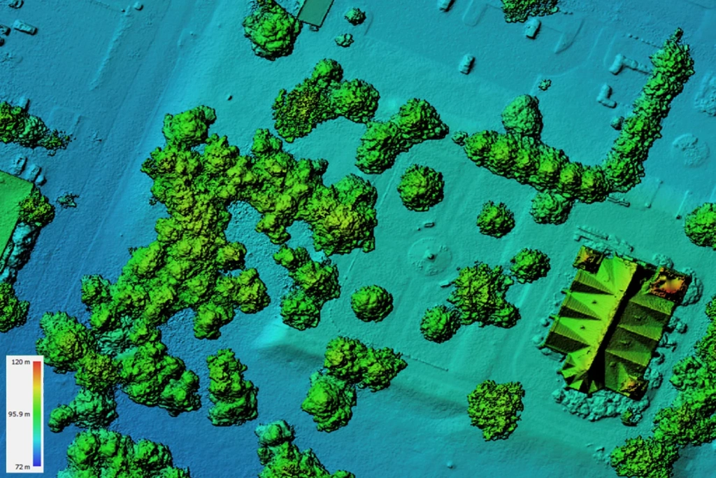
Data capture and production of topographic-plan materials: terrain, features, spot levels and digital base data.
Topographic plan
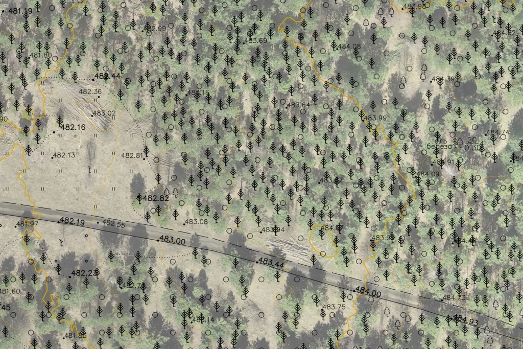
Digital base data
Engineering assets
A topographic plan can include a range of assets (e.g. overhead lines, buildings, roads and others) as vector features. We confirm the layer set and feature list in advance in the scope of work, so the final plan matches your project requirements.
We select equipment and methodology based on area, site conditions and the required outputs (topographic plan).
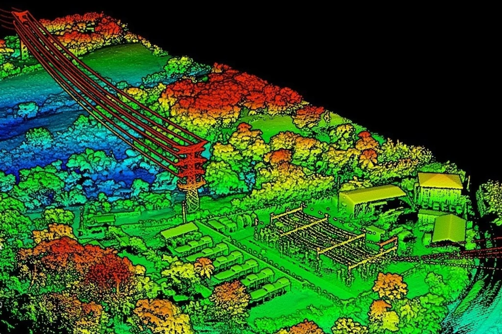
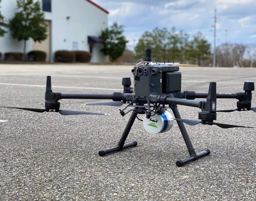
UAV
Primary area-wide data capture: photogrammetry provides a detailed orthomosaic, while LiDAR delivers dense terrain/surface geometry. We choose the method—or a combination—based on your requirements and site conditions.
MLS
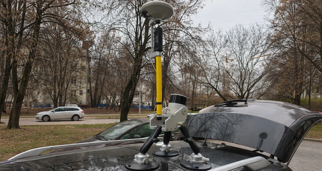
Ground-based detail for local areas: infrastructure, access routes, platforms, tie-ins and zones, where you need higher point density at asset level.
SLAM
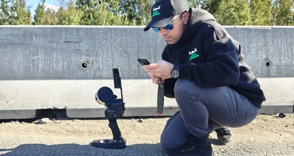
For areas with complex geometry and constrained conditions (for example under canopies, in dense urban areas, or where access is limited). QA methodology and deliverables are agreed in advance.
The final product is a topographic plan and supporting digital deliverables. We select the method to meet the required layer set and output quality.
A turnkey workflow: brief → data capture → processing → drafting → delivery.
Scope
A package for design, measurements and CAD/GIS workflows.
Topographic plan

Topographic plan at the agreed scale (1:500–1:5000), with layers and features to the scope of work.
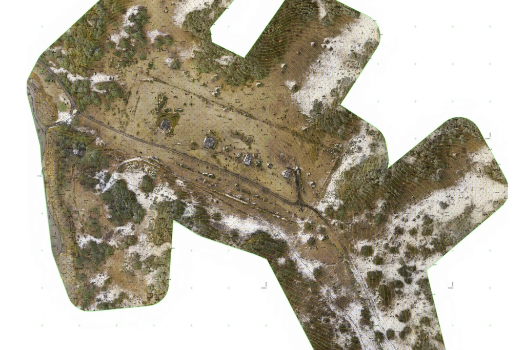
Orthomosaic

High-detail orthomosaic for referencing, analysis and cross-checking existing features.
Models
Digital terrain/surface models for measurements, profiles and analysis.
Export formats
Typically: DWG/DXF, SHP/GeoPackage, PDF. If required: LAS/LAZ and additional formats for your specific software stack.
Programme: from 1–2 days to several weeks. Cost: provided on request after a short brief.
Programme
Timeframes depend on the site area, complexity, the chosen method (imagery or LiDAR), any MLS/SLAM required for local areas and the deliverables set (plan, orthomosaic, models, point cloud).
Cost
Price depends on the scale (1:500–1:5000), area, selected technology (UAV imagery/LiDAR, MLS, SLAM), the layer/feature list and formats. Payment is made upon completion of the works.

Woodland
Undulating terrain
Image preview
Not sure about something?
If you have any questions and would like a consultation, email us at info@topodrone.com — we’ll walk you through the brief, deliverable formats and timeframes.