

TOPODRONE has received new DJI Enterprise equipment: the DJI Matrice 400, DJI Matrice 4E, and the Zenmuse L3 LiDAR. All items are in stock and ready for dispatch. These solutions are designed for surveying, mapping, cadastre, engineering surveys, monitoring, and infrastructure inspection.
Below is a brief overview of the key capabilities of the Matrice 400, Matrice 4E and Zenmuse L3.
DJI Matrice 400 — a powerful, versatile next-generation platform
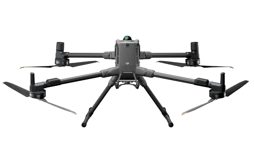
Image 1. DJI Matrice 400E — a versatile industrial platform
The DJI Matrice 400 is a DJI Enterprise industrial platform built for demanding operations where endurance, reliability and mission performance are critical. It is optimised for large-area mapping and linear corridor surveys, as well as workflows requiring flexible payload configurations (including non-traditional “survey” tasks such as thermal operations and advanced inspection).
Key capabilities — Matrice 400
- Flight time: up to 59 minutes with payload.
- Payload capacity and configurations: up to 6 kg, enabling multiple devices to be mounted to match specific operational scenarios.
- Mission performance: speeds up to 25 m/s for efficient acquisition over corridors and areas.
- Safety and navigation: LiDAR, mmWave radar and vision sensors for omnidirectional obstacle sensing, including detection of power lines.
- Industrial protection: IP55, operating temperatures −20 to +50 °C.
- Link and coverage: O4 Enterprise Enhanced, support for dual Cellular Dongle 2, plus airborne relay to eliminate “dead zones”.
- Broad payload support: compatible with DJI Zenmuse gimbals (LiDAR, photogrammetric cameras, thermal imagers, etc.), and with TOPODRONE LiDAR and cameras (LiDAR 100/100+/200+; P24 and P61 cameras).
The DJI Matrice 400 is available in a base version and Combo kit. Genuine DJI gimbals are also available.
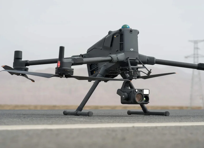
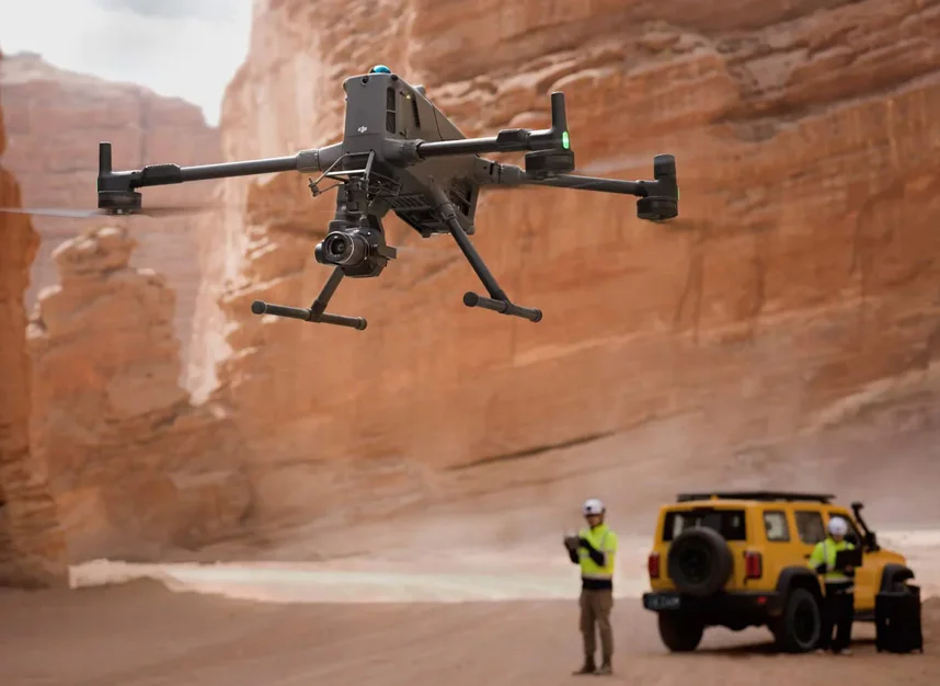

Image 2-4. DJI Matrice 400E drone equipped with Zenmuse series payloads
DJI Matrice 4E — an out-of-the-box solution for high-accuracy data capture
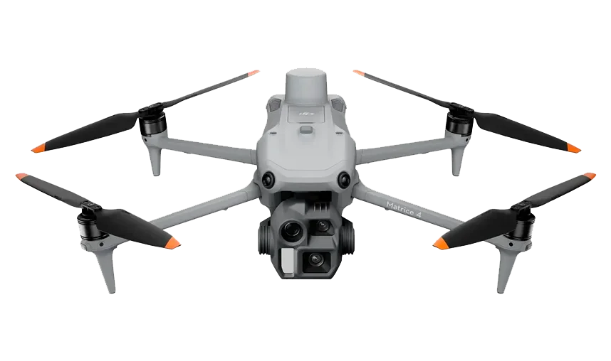
Image 5. DJI Matrice 4E
The DJI Matrice 4E is an industrial-grade drone with an integrated camera system. Its foldable design makes it highly portable for field crews. It is intended for surveying, mapping, cadastre, mining survey, engineering investigations, and construction/industrial site monitoring.
The platform combines capable optics, a mechanical shutter, and intelligent modes that streamline repeatable missions and consistent asset coverage.
Key capabilities — Matrice 4E
- Main camera: 4/3" CMOS, 20 MP + mechanical shutter (24 mm, f/2.8–f/11) — stable geometry and strong source imagery for orthomosaics and 3D reconstruction under varied lighting.
- Tele cameras: 70 mm and 168 mm (both 48 MP) — high detail at range for checking components, markings and structural elements.
- Laser rangefinder (LRF): up to 1,800 m (1 Hz) / up to 600 m at an oblique aim ratio of 1:5; 1 m blind zone — rapid measurements without close approach.
- AI and Smart modes: person/vehicle recognition plus FlyTo / POI / Smart Track / Cruise — less manual flying and easier repeatability.
- Zoom and detail: 112× hybrid — inspection of small elements at distances up to ~250 m (conditions dependent).
- Rapid mapping: 0.5 s capture interval; up to 21 m/s; 5-direction oblique and 3-direction nadir (ortho) capture; up to 2.8 km² per flight (under stated conditions).
- Reconstruction accuracy: factory calibration + distortion correction (<2 px), compatible with DJI Terra.
- Navigation and link: RTK (L5) + hybrid positioning (GNSS + vision); O4 Enterprise up to 25 km (ideal conditions), optional Cellular Dongle (4G).
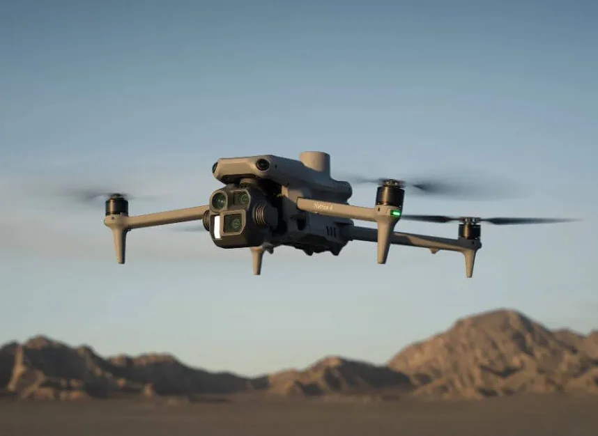
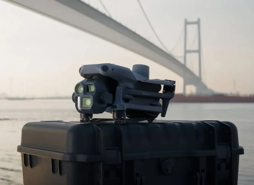
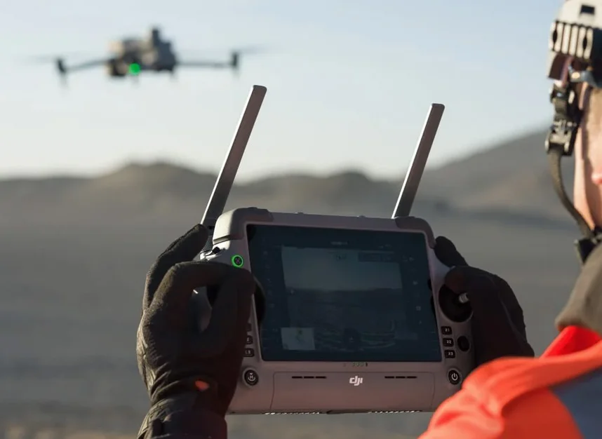
Image 6-8. DJI Matrice 4E drone in operation
DJI Zenmuse L3 — next-generation airborne laser scanning
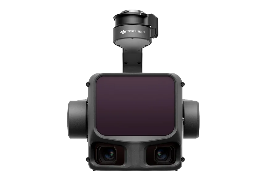
Image 9. Zenmuse L3
The DJI Zenmuse L3 is a new-generation airborne LiDAR solution. A high-accuracy LiDAR and two 100 MP cameras are integrated into a single unit, enabling capture of a georeferenced point cloud and colour information in one flight — without a separate photogrammetric mission for colourisation and alignment.
Key features — Zenmuse L3
- Combined module: LiDAR + two 100 MP cameras.
- Scanning range:
- 700 m (10% reflectivity, 350 kHz);
- 950 m (10% reflectivity, 100 kHz);
- Up to 2,000 m (80% reflectivity, 100 kHz).
- Density and detail: up to 1.2 million pts/s, up to 16 returns.
- Accuracy: POS module — ±3.5 cm vertical and ±5 cm horizontal.
- Intelligent modes: terrain-adaptive settings tailored to use case and survey scenario.
- DJI ecosystem integration: compatible with DJI Matrice 400; mission planning in DJI Pilot 2; processing in DJI Terra.
- Single-mission deliverables: point cloud + orthomosaic with precise georeferencing.
Zenmuse L3 delivers high productivity: up to 100 km² per working day (depending on conditions and required point density) and up to 10 km² per flight at 300 m AGL (under stated conditions). It is well suited to forestry, power/utility, and construction airborne laser scanning, as well as large-scale mapping and monitoring.
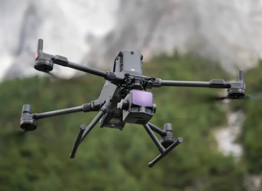
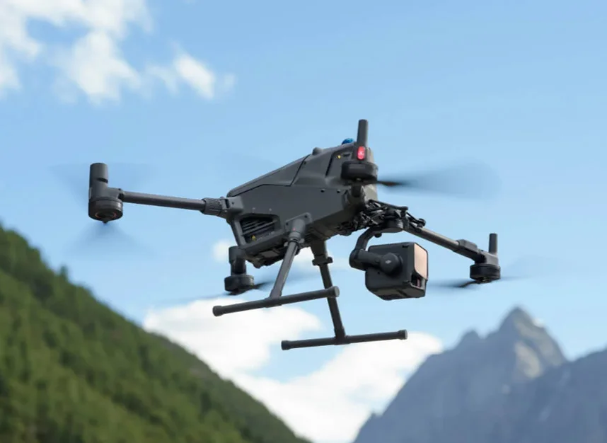
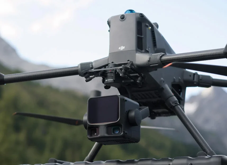
Image 10-12. DJI Matrice 400 with the Zenmuse L3 LiDAR installed
How to order
To choose the right configuration for your project and arrange supply, visit the relevant product pages or contact TOPODRONE specialists at info@topodrone.com. We provide turnkey solutions: platform/UAS selection, payloads, software, and supporting equipment tailored to professional requirements.
Throughout the service life, we provide technical support (via a specialist chat) and, upon request, deliver training in UAS operations, LiDAR data acquisition and processing, and photogrammetry workflows.